

The Great Wall of China is not a single unbroken ancient wall, but a succession of northern frontier fortifications — earthen ramparts, stone-and-brick battlements, beacon towers, and defensive ditches — built across northern China by rival kingdoms and imperial dynasties between the seventh century BC and the seventeenth century AD. Constructed to regulate nomadic cavalry movements, guard commercial corridors, and demarcate agrarian territory from the Eurasian steppe, it became the largest military engineering landscape in pre-modern history. Beyond the famous tourist ridges near Beijing, a 2012 national archaeological survey, chemical tests on Ming sticky-rice mortar, and recent steppe excavations reveal how radically these defences changed over two millennia.
Key facts
- Dates: 7th century BC (earliest Warring States walls of Chu and Qi) – 1644 AD (fall of the Ming dynasty)
- Location: Across 15 northern Chinese provinces, autonomous regions, and municipalities, from Jiayuguan in Gansu and Yumenguan on the desert frontier to Shanhaiguan on the Bohai Sea and Hushan in Liaoning
- Key rulers and commanders: King Xuan of Qi (4th century BC), Qin Shi Huang and General Meng Tian (221–210 BC), Emperor Wu of Han (r. 141–87 BC), Ming Emperor Jiajing (r. 1521–1567 AD), General Qi Jiguang (1528–1588 AD)
- Size and dimensions: 21,196.18 kilometres total across all dynasties (2012 SACH survey), including 8,851.8 kilometres of Ming dynasty defences; Ming masonry walls average 6 to 8 metres tall, with watchtowers rising 10 to 12 metres
- Outcome: Bypassed or breached during major dynastic transitions (including the Mongol conquest and the 1644 Manchu entry through Shanhaiguan), before becoming a protected national monument and UNESCO World Heritage Site in 1987
Who made China Great Wall from Qin to Ming
Answering who made China Great Wall requires separating at least four major eras of frontier construction: the rival states of the Warring States period, the short-lived Qin unification of 221 BC, the westward Han expansion, and the sixteenth-century Ming masonry rebuild. Rather than upgrading a single permanent line, each dynasty built along different latitudes using local materials and conscripted soldiers, convicts, and peasant corvée labourers.
Warring States, Qin Shi Huang and the Han frontier
Wall-building along the northern steppe began centuries before China was unified. As historian Nicola Di Cosmo demonstrated in Ancient China and Its Enemies (2002), regional states during the Spring and Autumn and Warring States periods (770–221 BC) first erected long rammed-earth barriers (changcheng) against one another, beginning with the southern state of Chu in the seventh century BC and the eastern state of Qi. By the late fourth and early third centuries BC, the northern states of Yan, Zhao, and Qin adopted cavalry warfare and pushed northward into pastoral lands, constructing long earthen dykes across Inner Mongolia and Shanxi to fence out Hu and Xiongnu horse archers.
After conquering the last rival kingdoms in 221 BC, the First Emperor, Qin Shi Huang — whose funerary complex is examined in our article on the Terracotta Army and Qin Shi Huang’s mausoleum — ordered his general Meng Tian to campaign north of the Yellow River loop in 215–214 BC. In Chapter 88 of the Shiji (Records of the Grand Historian), completed around 94 BC and translated by Burton Watson for Columbia University Press, Han court historian Sima Qian recorded that Meng Tian mobilised 300,000 men to drive out the Xiongnu and link the older northern walls of Qin, Zhao, and Yan from Lintao in Gansu to Liaodong into a “wall of ten thousand li” (wanli changcheng). Sima Qian noted that Meng Tian relied on natural mountain defiles, dug trenches, and repaired existing earthen embankments rather than building a brand-new stone wall from scratch.
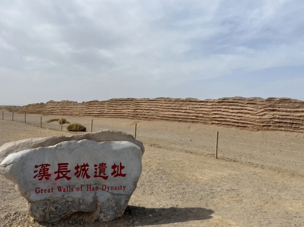
Following the collapse of the Qin dynasty in 206 BC, the Western Han dynasty (202 BC–9 AD) initially tried to appease the Xiongnu confederacy through diplomatic marriage treaties (heqin). Under Emperor Wu of Han (Han Wudi, r. 141–87 BC), imperial armies went on the offensive, seizing the Hexi Corridor in Gansu and extending a new line of rammed-earth walls and mud-brick beacon towers (fengsui) far into the western desert past Dunhuang and Yumenguan (Jade Gate Pass) to shelter the caravan routes of the Han Dynasty Silk Road.
The sixteenth-century Ming dynasty rebuild
After the fall of the Han in 220 AD, only northern frontier regimes — notably the Northern Wei, Northern Qi, Sui, and Jurchen Jin — periodically dug border ditches or earthen walls, while cosmopolitan dynasties such as the Tang (618–907 AD) and the Mongol Yuan dynasty (1271–1368 AD) rejected border walls entirely because they controlled or campaigned deep inside the steppe.
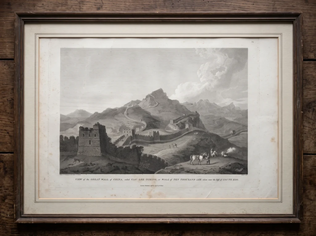
As Arthur Waldron proved in his landmark study The Great Wall of China: From History to Myth (1990), published by Cambridge University Press, the iconic stone-and-brick Great Wall of China that visitors walk on today was built by the Ming dynasty (1368–1644 AD) roughly 1,500 years after Qin Shi Huang. For its first eighty years, the Ming court relied on offensive garrisons rather than continuous walls. That strategy collapsed after the 1449 Tumu Crisis, when Oirat Mongols captured the Zhengtong Emperor in battle. In the 1470s, Ming commanders walled off the Ordos desert loop with packed earth, and between the 1540s and 1580s — documented in the Ming Shilu (Veritable Records of the Ming Dynasty, digitized by the National University of Singapore) and analysed by historian David Spindler — Emperor Jiajing, Chief Grand Secretary Zhang Juzheng, and General Qi Jiguang encased the strategic passes north of Beijing in dressed granite blocks and millions of kiln-fired grey bricks.
Why was the Wall of China built and how tall is the Great Wall of China
Understanding why was the Wall of China built and how tall is the Great Wall of China requires looking at how Chinese military engineers adapted wall geometry to stop mobile steppe horsemen, transmit rapid smoke signals, and match local geology from desert loess to mountain granite.
Purpose of Great Wall of China
No Chinese commander expected an unmanned linear wall to stop a determined nomadic army forever. Instead, the Great Wall of China functioned as a tactical delay-and-communication system designed to strip steppe cavalry of their two greatest advantages: speed and surprise. A continuous rampart of five to eight metres forced raiding horsemen to dismount, build scaling ladders, or breach a narrow gatehouse — giving Chinese garrison infantry and crossbows stationed in nearby fortress towns time to march to the point of attack, and blocking raiders from driving captured horses and livestock back across the border.
Equally critical was the integrated early-warning network. Along both the Han desert lines and the Ming mountain ridges, detached and wall-mounted beacon towers stood within direct line of sight of one another. Under Ming military regulations, lookouts burned wolf dung, sulphur, and damp brushwood to send dense columns of smoke by day and lit braziers by night, paired with iron signal cannon (chong). The number of smoke plumes or cannon shots communicated the exact size of an approaching Mongol force, relaying an alarm across hundreds of kilometres to the Ministry of War in Beijing within hours. In peacetime, fortified gate complexes such as Jiayuguan and Zhangjiakou acted as customs checkpoints where Ming officials regulated horse fairs, taxed satin and tea exports, and prevented iron weapons from being smuggled into the steppe.
How tall is the Great Wall of China and how it was built
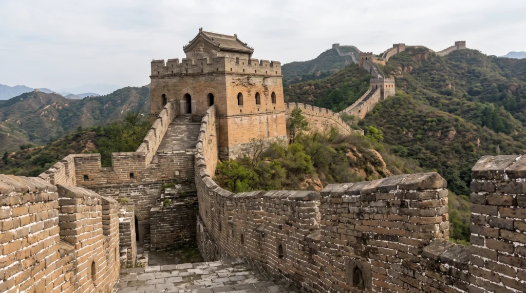
Because the fortifications span two thousand years and fifteen provinces, answering how tall is the Great Wall of China depends on whether one measures eroded ancient earthworks or intact sixteenth-century Ming masonry. Along the best-preserved Ming sections north of Beijing — such as Badaling, Mutianyu, Jinshanling, and Simatai — the main curtain wall averages 6 to 8 metres (20 to 26 feet) in height, measuring 6 to 7 metres wide at the base and tapering to 4 to 5 metres wide along the paved top walkway, flanked by crenelated outer parapets nearly 2 metres high. Two- and three-storey hollow brick watchtowers (ditai), introduced along the Jizhou Defense Command by General Qi Jiguang in the 1570s to house soldiers and store arquebuses, gunpowder, and provisions, rise 10 to 12 metres (33 to 40 feet) high. By contrast, surviving Qin and Han rammed-earth sections in Gansu and Inner Mongolia have weathered down to low mounds between 1 and 4 metres tall, though a few Han mud-brick beacon towers still stand 6 to 9 metres high.
Construction methods divided sharply between ancient hangtu (rammed earth) and late Ming masonry. Under the Qin and Han, conscripted soldiers and peasant labourers erected parallel wooden shuttering boards and pounded layers of local loess soil, coarse gravel, and water down to compact ten-centimetre strata using wooden pestles. In the arid Hexi Corridor near Dunhuang — where Aurel Stein documented the Han limes for the British Library’s International Dunhuang Project — builders alternated layers of pounded desert sand and clay with thick mats of desert reeds (Phragmites) and tamarisk branches to bind the wall against wind erosion. Sixteen centuries later, Ming engineers quarried massive rectangular granite and limestone foundation blocks to anchor the wall into steep mountain spines, filled the rubble core with earth and crushed stone, and faced the exterior and vaulted watchtowers with standardized kiln-fired grey bricks hauled up mountain trails by human porters, mules, and goats.
Where is the Great Wall of China: Route, decay and modern survival
Ask a map where is the Great Wall of China, and the answer spans a 4,000-kilometre east–west arc across fifteen northern Chinese provinces, autonomous regions, and municipalities: Beijing, Tianjin, Hebei, Shanxi, Inner Mongolia, Liaoning, Jilin, Heilongjiang, Shandong, Henan, Shaanxi, Gansu, Ningxia, Qinghai, and Xinjiang.
The northern route from the Bohai Sea to the Gobi Desert
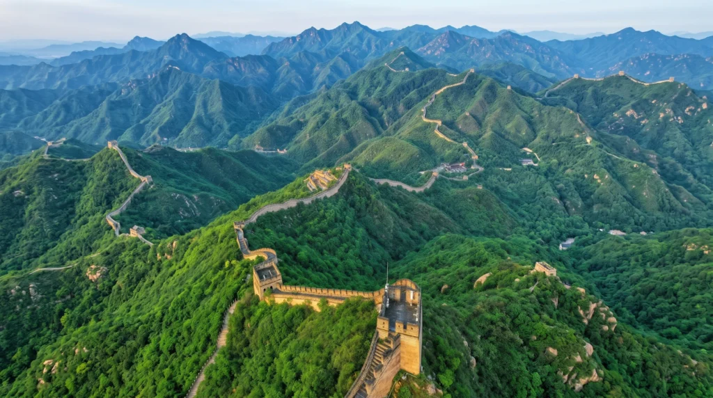
The better-preserved Ming dynasty wall traces a continuous strategic corridor of 8,851.8 kilometres across nine provincial jurisdictions. In the east, it begins at Hushan (“Tiger Mountain”) in Liaoning near the Yalu River border with North Korea and meets the Bohai Sea at Shanhaiguan (“Mountain-Sea Pass”) in Hebei, where the restored “Old Dragon’s Head” (Laolongtou) stone pier juts directly into the ocean surf. From Shanhaiguan, the Ming line snakes westward across the rugged Yanshan and Taihang mountain ranges north of Beijing and Tianjin — splitting into an “Outer Wall” along the Inner Mongolian border and an “Inner Wall” guarding the strategic passes of Juyongguan, Badaling, Mutianyu, Gubeikou, and Jinshanling.
West of Beijing, the Ming system runs across northern Shanxi and Shaanxi along the southern edge of the Ordos Desert loop, cuts through Ningxia, and follows the Hexi Corridor in Gansu between the snow-capped Qilian Mountains and the Tengger Desert before terminating at Jiayuguan (“Jiayu Pass”), a trapezoidal mud-brick and masonry fortress built around 1372 AD. Older Warring States, Qin, Han, and Jin walls lie along entirely different alignments: Qin and Han lines run hundreds of kilometres further north across the Yinshan mountains of Inner Mongolia and extend west of Jiayuguan to Yumenguan and Lop Nor in Xinjiang, while twelfth-century Jurchen Jin trenches cut across north-eastern Inner Mongolia and Heilongjiang.
Decay, restoration and modern tourism
The military utility of the Ming wall ended in May 1644, not because nomadic cavalry battered down the masonry, but because rebel leader Li Zicheng captured Beijing from within, prompting the Ming frontier commander Wu Sangui to open the gates of Shanhaiguan to the Manchu Qing armies. Because the Qing dynasty (1644–1912 AD) incorporated Manchuria and Mongolia into the empire, the court abandoned the Ming wall to three centuries of natural weathering.
As Julia Lovell (The Great Wall: China Against the World, 2006) and Carlos Rojas (The Great Wall: A Cultural History, 2010) document, the wall’s modern resurrection began in the 1950s when the People’s Republic of China restored the Badaling section outside Beijing as a diplomatic showcase, culminating in Deng Xiaoping’s 1984 preservation campaign (“Let us love our country and restore our Great Wall”) and UNESCO World Heritage inscription in 1987. Today, while sections like Badaling and Mutianyu receive over ten million visitors a year, SACH conservation surveys estimate that roughly 30 percent of the Ming masonry wall has vanished completely and less than 10 percent remains in good structural condition — threatened by freeze-thaw cracking, desert sandstorms, “wild wall” hiking, and historical brick-scavenging by rural villagers prior to the 2006 State Council Regulation on the Protection of Great Wall.
What the 2012 survey, sticky-rice mortar and steppe excavations reveal
Three bodies of twenty-first-century scientific research — China’s five-year GPS and infrared archaeological survey, chemical analysis of Ming organic mortar, and excavations along the Mongolian steppe — have overturned long-standing assumptions about the wall’s total length, structural resilience, and medieval purpose.
The survey and the chemistry of sticky-rice mortar
For generations, reference books repeated a rough figure of 5,000 kilometres (10,000 li) for the Great Wall of China based on literal readings of Sima Qian’s idiom wanli changcheng. Between 2007 and 2012, China’s State Administration of Cultural Heritage (SACH) and the State Bureau of Surveying and Mapping deployed GPS, infrared rangefinders, and remote-sensing drones to map every surviving wall trace on the ground. Released in two stages (April 2009 for the Ming system and June 2012 for all dynasties), the survey identified 43,721 individual heritage sites — walls, trenches, fortresses, and beacon towers — totalling 21,196.18 kilometres. Crucially, the SACH report broke the 8,851.8-kilometre Ming total into three distinct categories: 6,259.6 kilometres of actual human-built wall masonry and earthworks, 359.7 kilometres of dug boundary trenches, and 2,232.5 kilometres of impassable natural river and cliff barriers integrated into the defensive line.
Meanwhile, analytical chemists solved the mystery of why sixteenth-century Ming brickwork withstood major earthquakes and prevented weeds from splitting the joints. In a landmark 2010 study published in the American Chemical Society’s Accounts of Chemical Research, materials scientist Fuwei Yang, Bingjian Zhang, and Qinglin Ma at Zhejiang University analysed historical Ming mortar samples using X-ray diffraction, Fourier-transform infrared spectroscopy, and iodine-starch chemical tests. They proved that Ming masons mixed traditional slaked-lime mortar (calcium hydroxide) with roughly three to five percent sticky-rice soup (glutinous rice porridge). The branched polysaccharide amylopectin in the sticky rice acted as a biopolymer inhibitor: as the calcium carbonate crystallised during curing, the amylopectin controlled crystal growth, producing a tightly packed micro-nanostructure of needle-like calcite crystals that gave the organic-inorganic composite mortar far higher compressive strength, water resistance, and toughness than pure lime mortar.
What historians still debate about medieval steppe walls
Even with the 2012 SACH inventory and laboratory mortar tests, archaeologists continue to debate the purpose of thousands of kilometres of non-Ming walls on the northern steppe. Between 2020 and 2024, an international archaeological team led by Gideon Shelach-Lavi at the Hebrew University of Jerusalem excavated sections of the 405-kilometre “Mongolian Arc” and the 737-kilometre Northern Line built across eastern Mongolia and north-eastern China during the Khitan Liao and Jurchen Jin dynasties (10th to 13th centuries AD).
Published in Antiquity (2020) and the Journal of Field Archaeology (2024), their trenches revealed shallow earthen banks only 1 to 1.5 metres high paired with outer ditches sited in flat valleys rather than on defensible mountain crests. Shelach-Lavi’s team argued that these medieval steppe walls were never designed to stop invading armies; instead, they functioned as civilian infrastructure to monitor pastoral migration, collect livestock taxes, and guide refugees during extreme winter blizzards (dzud). Other military historians counter that the ditches still served to slow cavalry raids when combined with mobile frontier patrols, leaving the balance between military defense and civilian border policing an active debate across East Asian archaeology.
Tracing the Great Wall of China across more than twenty-two centuries — from the tamped-earth border dykes of Warring States kingdoms and Qin Shi Huang’s general Meng Tian to the brick-and-granite watchtowers of Ming general Qi Jiguang — replaces the myth of a single timeless monument with a history of constant technological adaptation. What tourists photograph at Badaling and Jinshanling is not the relic of ancient unification in 221 BC, but the culmination of sixteenth-century Ming military engineering held together by amylopectin sticky-rice mortar. Read alongside China’s 21,196-kilometre survey and recent excavations on the Mongolian steppe, the wall emerges not as one unchanging line of isolation, but as a shifting, multi-dynastic frontier zone where agrarian empires and nomadic powers negotiated war, trade, and ecology.
References
Primary sources
- Sima Qian, Records of the Grand Historian: Qin Dynasty, trans. Burton Watson (Hong Kong and New York: Research Centre for Translation, Chinese University of Hong Kong, and Columbia University Press, 1993), Chapter 88 (“The Biography of Meng Tian”), pp. 207–214.
- Geoff Wade, trans., Southeast Asia in the Ming Shi-lu: An Open Access Resource (Singapore: Asia Research Institute and the Singapore E-Press, National University of Singapore, 2005), accessed 13 November 2026, https://epress.nus.edu.sg/msl/.
- State Administration of Cultural Heritage (SACH) and State Bureau of Surveying and Mapping, National Archaeological Survey Report on the Length of the Great Wall of China (Beijing: State Administration of Cultural Heritage, 2009 and 2012).
Secondary sources
- Arthur Waldron, The Great Wall of China: From History to Myth (Cambridge: Cambridge University Press, 1990).
- Nicola Di Cosmo, Ancient China and Its Enemies: The Rise of Nomadic Power in East Asian History (Cambridge: Cambridge University Press, 2002).
- David Spindler, “A Twice-Scorned Mongol Woman, the Raid of 1576, and the Building of the Brick Great Wall,” Ming Studies 2009, no. 60 (2009): 66–94. DOI: 10.1179/175975909X12589849512419.
- Fuwei Yang, Bingjian Zhang, and Qinglin Ma, “Study of Sticky Rice−Lime Mortar Technology for the Restoration of Historical Masonry Construction,” Accounts of Chemical Research 43, no. 6 (2010): 936–944. DOI: 10.1021/ar9001944.
- Julia Lovell, The Great Wall: China Against the World, 1000 BC – AD 2000 (London: Atlantic Books, 2006).
- Carlos Rojas, The Great Wall: A Cultural History (Cambridge, MA: Harvard University Press, 2010).
- Gideon Shelach-Lavi, Ido Wachtel, Dan Golan, Otgonjargal Batzorig, Amartuvshin Chunag, Ronnie Ellenblum, and William Honeychurch, “Medieval Long-Wall Construction on the Mongolian Steppe During the Eleventh to Thirteenth Centuries AD,” Antiquity 94, no. 375 (2020): 724–741. DOI: 10.15184/aqy.2020.51.
- Gideon Shelach-Lavi, Dan Golan, Amartuvshin Chunag, Galbadrakh Batsuuri, Ido Wachtel, and William Honeychurch, “Unraveling the Mongolian Arc: A Field Survey and Spatial Analysis of an Enigmatic Medieval Wall System in Eastern Mongolia,” Journal of Field Archaeology 49, no. 4 (2024): 225–242. DOI: 10.1080/00934690.2023.2295198.
Further reading (not drawn on for this article)
- Arthur N. Waldron, “The Problem of The Great Wall of China,” Harvard Journal of Asiatic Studies 43, no. 2 (1983): 643–663. DOI: 10.2307/2719110.
- Aurel Stein, Ruins of Desert Cathay: Personal Narrative of Explorations in Central Asia and Westernmost China, 2 vols. (London: Macmillan, 1912).
- Owen Lattimore, Inner Asian Frontiers of China (New York: American Geographical Society, 1940).